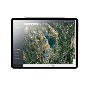
Terraweb aims to give immediate view of the situation of any civil engineering project, asset, infrastructure, mine, high rise building, landslide area etc. It is a complete management solution for monitoring construction with topographical, geotechnical and environmental sensors.It offers Google Map navigation, graphical navigation, expandable graphs giving a quick view of all the monitoring data.
Terraweb can accept input from a wide variety of dataloggers such that the user has an easy access to all the information on a single platform for risk management, evaluation, interpretation and decision-making. It also accepts manual monitored data, images, diagrams, drawings, etc.
Site location, meaningful instrumentation data is available at a mouse click to monitor performance of project in real time, with instant warnings. The early warnings help in taking timely corrective actions to prevent damages/delays and in reducing operational costs.
- User-friendly interface with one-click access to all instrument data in one platform
- Layout plan can be incorporated with locations of each monitoring sensor.
- Facility to import measurements from ATS (automatic total station) systems directly
- Supports up to 6 TBMs connected simultaneously and gives real-time monitoring report for each TBM.
- Can access borehole data as well as building condition survey reports
- Additional feature for filtering raw data through moving average filter
- Instant automatic alerts via SMS or email to authorized personnel
- User customizable graphs based on the selection of active project areas
- Generate reports automatically for each sensor. Can generate daily, weekly or monthly report
- Provides combined graphs using the profile, TBM parameters, settlements and piezometers.


